This off-the-shelf array of products comprises of data collected using aerial photography, land, and LiDAR surveys with coverage of over 60 towns in Kenya and 2 major cities in Uganda. The first of its kind in East Africa, Ramanis Citi Data library has been collected over years up to and including 2017. Historical imagery of Nairobi dating as far back as 1978 is also available.
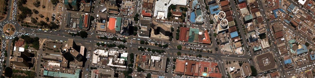
 Citi Image is ready-to-go high resolution ortho-rectified imagery derived from digital aerial photography. Majority of these mosaic images have been acquired using mapping-grade Applanix DSS439 camera while the rest have been captured using the Microsoft UltraCam X camera. Available as raw images or mosaics, Citi image provides a visual planning tool, the basis for mapping and land use classification.
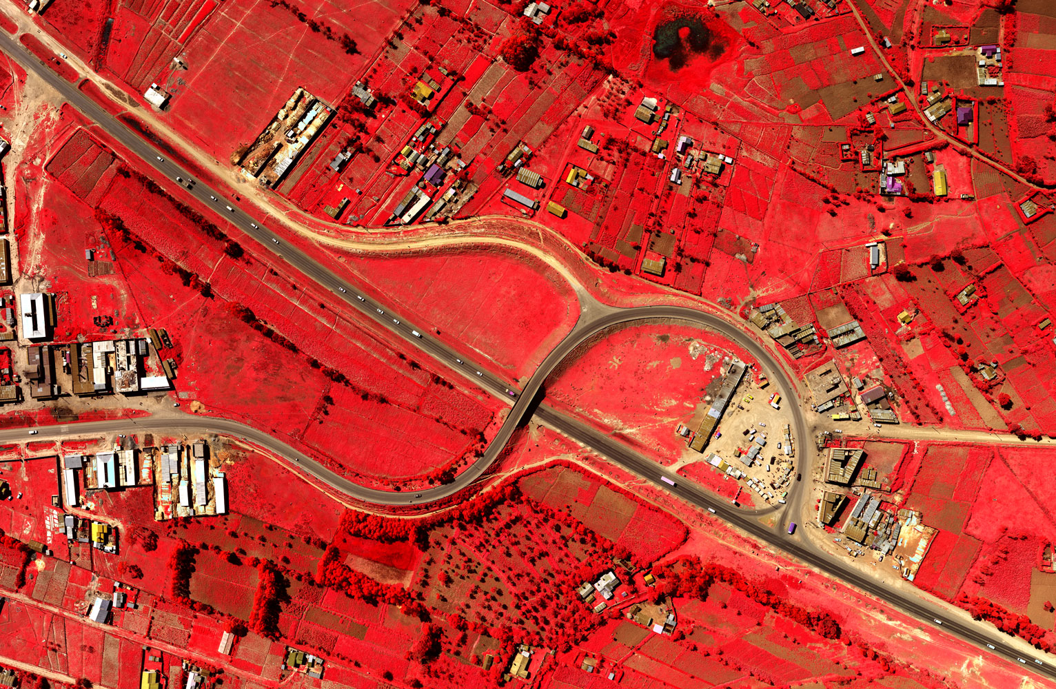
Specifications
- 60% forward and 30% lateral overlap for stereo vision
- 10-20cm resolution
- Available in RGB and InfraRed*
- 50+ towns in Kenya | 2 cities in Uganda
* Selected areas only

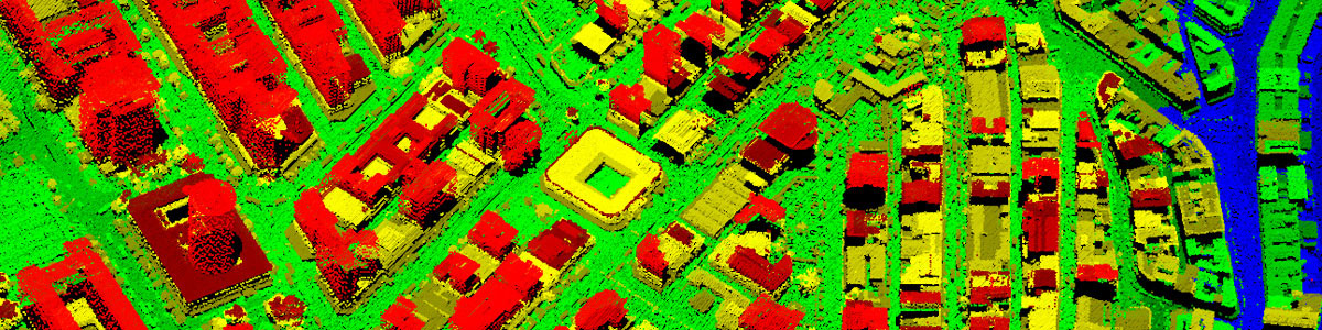
 Citi LiDAR is processed and geo-referenced LiDAR point cloud captured by the Leica ALS60 sensor. This product is available for some major cities with the average point density ranging from 1 to 3 points per square meter. Citi LiDAR is typically delivered as ground and non ground classes, but detailed classification can also be carried out on request to include classes such as buildings, vegetation and other surface features.
Citi LiDAR is widely used to support detailed powerline, rail, road and pipeline design as well as other engineering grade applications. The derivatives are also useful for supporting 3D visualization and simulations.
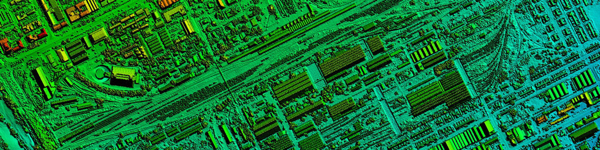
 Citi Terrain provides elevation models derived from both aerial photography and aerial LiDAR surveys. Being a direct measurement technique, aerial LiDAR survey outputs Digital Terrain Models (DTM) and Digital Surface Models (DSM) with minimal processing. With such models, the LiDAR-based Citi Terrain is best suited for engineering grade applications due to its high level of detail and accuracy.
For Aerial Photography, the elevation models are generated using advanced matching algorithms followed by manual and interactive editing. These elevation models are better suited for spatial planning and environmental mapping which do not require high accuracy.
Specifications
Available Citi Terrain grid sizes range from 5 - 20 metres with 0.2m planimetric and 0.5m height accuracies.
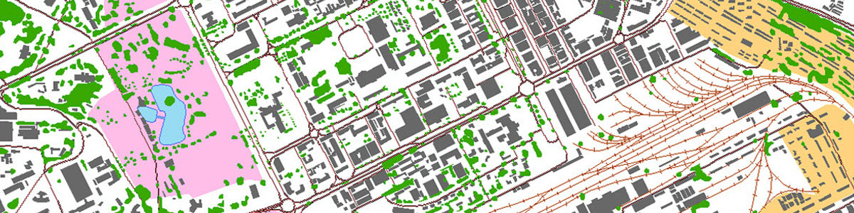
 Citi Vector is two-dimensional (2D) and/or three-dimensional (3D) vector data derived from digital imagery and LiDAR. The 2D vector data has been captured from high resolution image mosaics using high end GIS mapping software. The 3D vector, on the other hand, has been derived from stereoscopic images. Where LiDAR data is available, the two have been integrated using state-of-the-art stereo mapping technology.
Citi Vector mainly includes data on buildings and roads with vegetation and boundaries. Such datasets are used in creation of base maps to support urban planning, building routing solutions and environmental mapping.
About Ramani
Putting Africa on the Map with professional land surveying, aerial photography, aerial LiDAR, online spatial data and GIS and mapping services.

Contact Us
P.O. Box 15353 - 00509, Nairobi, Kenya.
Wilken House, Wilson Airport, Langata Road
Mobile: +254 (0)722 200 616
Email: info@ramani.co.ke
Uganda Office
P.O. Box 21759, Kampala, Uganda.
Plot 30 Kanjokya Street
Mobile: +256 773 261 995
Email: info@ramani.co.ug
Stay Connected
2017 © Ramani Geosystems. ALL Rights Reserved. Privacy Policy | Terms of Service