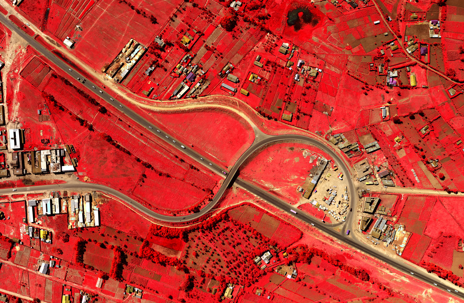
 Ramani offers high resolution aerial photography using the large format Microsoft Ultra Cam X camera which gives accuracies of between 5 – 25cm and aerial LiDAR solution using the Leica ALS60 with up to 10 points per m2.
Ramani operates two aerial survey aircraft: a Cessna 182 and a Cessna 206 Turbo for projects within east and central Africa. Both aircraft are operated under an AOC by two full-time pilots with backup pilot(s) available on demand.
In addition, Ramani has a partnership with ConversationAirPatrol which allows for aerial surveys to be carried out worldwide using the Cessna Caravan 208B with 1400nm plus reserve (standard configuration) endurance. This allows for very high- resolution surveys to be captured regardless of location and size of the project.
Based strategically at Nairobi’s Wilson Airport, we are able to offer timely aerial photography regardless of location.
About Ramani
Putting Africa on the Map with professional land surveying, aerial photography, aerial LiDAR, online spatial data and GIS and mapping services.

Contact Us
P.O. Box 15353 - 00509, Nairobi, Kenya.
Wilken House, Wilson Airport, Langata Road
Mobile: +254 (0)722 200 616
Email: info@ramani.co.ke
Uganda Office
P.O. Box 21759, Kampala, Uganda.
Plot 30 Kanjokya Street
Mobile: +256 773 261 995
Email: info@ramani.co.ug
Stay Connected
2017 © Ramani Geosystems. ALL Rights Reserved. Privacy Policy | Terms of Service