

Based on our experience since inception in 1999, Ramani solutions have been carefully packaged to cater to the divergent industry needs. These spatial solutions which include survey and mapping services can be tailored to meet project requirements for application in sectors e.g. energy, telco, highways and roads, aviation, urban planning, architecture and public works among others.
By combining our expertise and modern technology to meet market demands, we offer the following solutions:
- Aerial Survey
- Land Survey
- GIS & Mapping Solutions
- Online Mapping
- Consultancy and Training
These solutions enable us to integrate a variety of disciplines and technologies into complete packages, enabling our clients meet their objectives with quality and consequently add value to their workflow.
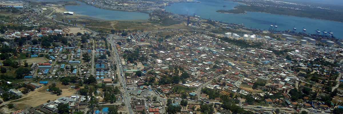
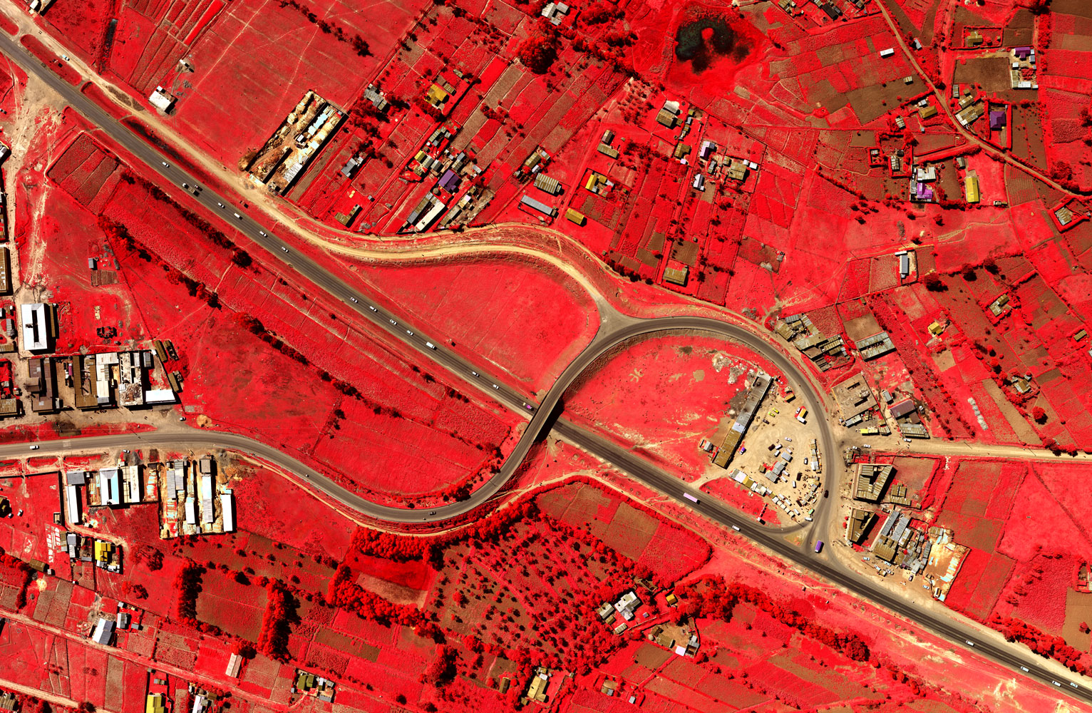
 Ramani offers high resolution aerial photography using the large format Microsoft Ultra Cam X camera which gives accuracies of between 5 – 25cm and aerial LiDAR solution using the Leica ALS60 with up to 10 points per m2.
Ramani operates two aerial survey aircraft: a Cessna 182 and a Cessna 206 Turbo for projects within east and central Africa. Both aircraft are operated under an AOC by two full-time pilots with backup pilot(s) available on demand.
In addition, Ramani has a partnership with ConversationAirPatrol which allows for aerial surveys to be carried out worldwide using the Cessna Caravan 208B with 1400nm plus reserve (standard configuration) endurance. This allows for very high- resolution surveys to be captured regardless of location and size of the project.
Based strategically at Nairobi’s Wilson Airport, we are able to offer timely aerial photography regardless of location.

Ramani Land Services is a recognized leader in the field of land survey solutions offering exceptional services to land developers, farmers, engineering contractors, property owners, legal and financial representatives, public utilities, and real estate developers, among others.
Services:
|
|
We meet this broad spectrum of surveying and engineering needs by offering high-quality work within reliable turnaround timelines, and in unparalleled professionalism.
Terrestrial LiDAR
Among the various unique survey services, Ramani also undertakes Terrestrial Laser Scanning services throughout Eastern Africa. Applications such as open mine pit surveys, stockpile computations, heritage and archeology benefit immensely from this solution.

Ramani Geospatial is a round-the-clock team that provides mapping services for clients looking to collect and manage earth related data. From the initial data capture & acquisition, processing, analysis, and to the final output, this department is able to provide comprehensive GIS & mapping solution fully tailored for customers' need.
At Ramani, we apply our experiences to define, design and deliver outstanding solutions and work with clients to develop customized solutions.
Our Consultancy and Training is primarily designed on project basis but is available to other clients if need arises. Our typical project-based training is done to facilitate a smooth transition in our solution implementation and hand over.
This usually includes database design and development, routine maintenance and updates of spatial data as well as project based capacity building for maintenance of the implemented systems. Ramani banks on the skilled, experienced and professional nature of its senior technical staff to implement these solutions.
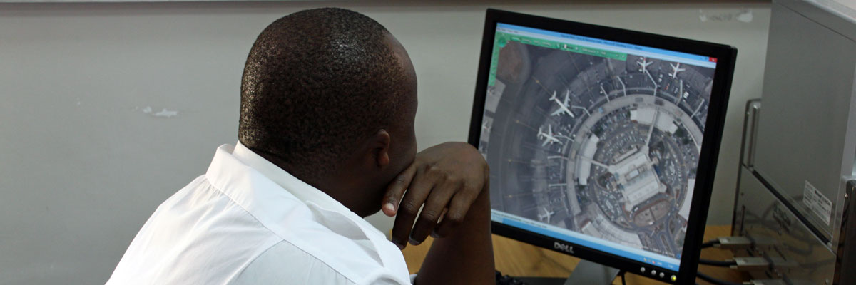
 Ramani ONLINE is a subscription service that provides access to a huge repository of spatial data. What makes Ramani Online unique is all this data can be accessed, managed, and manipulated without the use of any special software; all that is required is an internet connection and you can have Maps at Your Fingertips!
The layers available on Ramani Online include:
|
|
The data on Ramani Online is updated periodically and available in these 5 subscription tiers:
- Enterprise
- Platinum
- Gold
- Silver
- Bronze
About Ramani
Putting Africa on the Map with professional land surveying, aerial photography, aerial LiDAR, online spatial data and GIS and mapping services.

Contact Us
P.O. Box 15353 - 00509, Nairobi, Kenya.
Wilken House, Wilson Airport, Langata Road
Mobile: +254 (0)722 200 616
Email: info@ramani.co.ke
Uganda Office
P.O. Box 21759, Kampala, Uganda.
Plot 30 Kanjokya Street
Mobile: +256 773 261 995
Email: info@ramani.co.ug
Stay Connected
2017 © Ramani Geosystems. ALL Rights Reserved. Privacy Policy | Terms of Service